Description
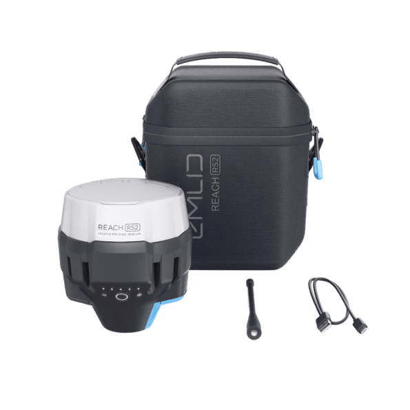
Emlid Reach RS2 product review
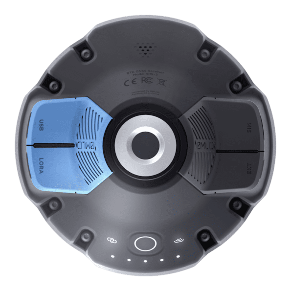
This unique, modern RTK GPS receiver comes with some excellent features that make it stand out. For instance, the receiver will get a VRS RTK fix in a matter of seconds and maintain a perfect performance despite the conditions. This is the GPS receiver to use if you need centimetre accuracy that can be gotten on distances of more than 100 km in PPK and 60 km in RTK. The Emlid Reach RS2 GPS is one of the few RTK system that come with compact batteries with fantastic battery life. On a full charge, this battery will function for at least 22 hours when logging data and at least 16 hours when using this RTK system as a GPS rover. But if you feel that this is not enough to serve your needs, you can use a power bank over USB-C to charge this Rover GPS system on the go. Even with that option, you will enjoy premium functionality of this GPS antenna.
The Emlid Reach RS2 RTK GPS receiver is highly power-efficient and features a 2G fallback as well as global coverage. Additionally, the RINEX data logs are naturally compatible with CSRS-PPP, OPUS, AUSPOS, and many other PPP services, which means you will get to enjoy centimetre accuracy despite your location. The RTK GPS system lets you process RINEX files online while enjoying premium accuracy. Durability IP67, Shockproof, 5/8”
Emlid Reach RS2 GPS antenna is crafted with an impressive level of impact resistance. The main body of the device is manufactured using a two-step injection process. The body’s internal layer is moulded from polycarbonate, which is a highly durable material that does not get affected by destructive weather elements a land surveyor is confronted with while doing GPS survey work. Amid the moulding process, a precision CNC machine threaded is inserted to form a single layer with the plastic. A special elastomer is used to cover the hard outer shell so that a shock absorber is formed around the device, thereby protecting it from impact.
Collecting points with the Reach RS2
The most user-friendly software for data collection that is available both for Android and iOS. With ReachView, you can collect and stake out points and control all the features of Reach receivers, such as setting up a base station, logging RINEX data, and configuring NMEA output.
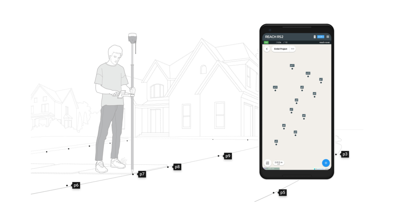
Create projects, save points and export in industry standard formats. Record each position as a point with centimeter precise coordinates. Export projects and open them in GIS or CAD software like AutoCAD, ArcGIS, QGIS, and others. Most common used formats are
- DXF
- CSV
- GeoJSON
- ESRI
- Shapefile
Measure in local coordinate systems
with the Free Emlid ReachView app you can measure within your own coordinate system like RDNAP for The Netherlands and Lambert for Belgium.
Stakeout: Find points and positions on the ground with the Emlid RS2
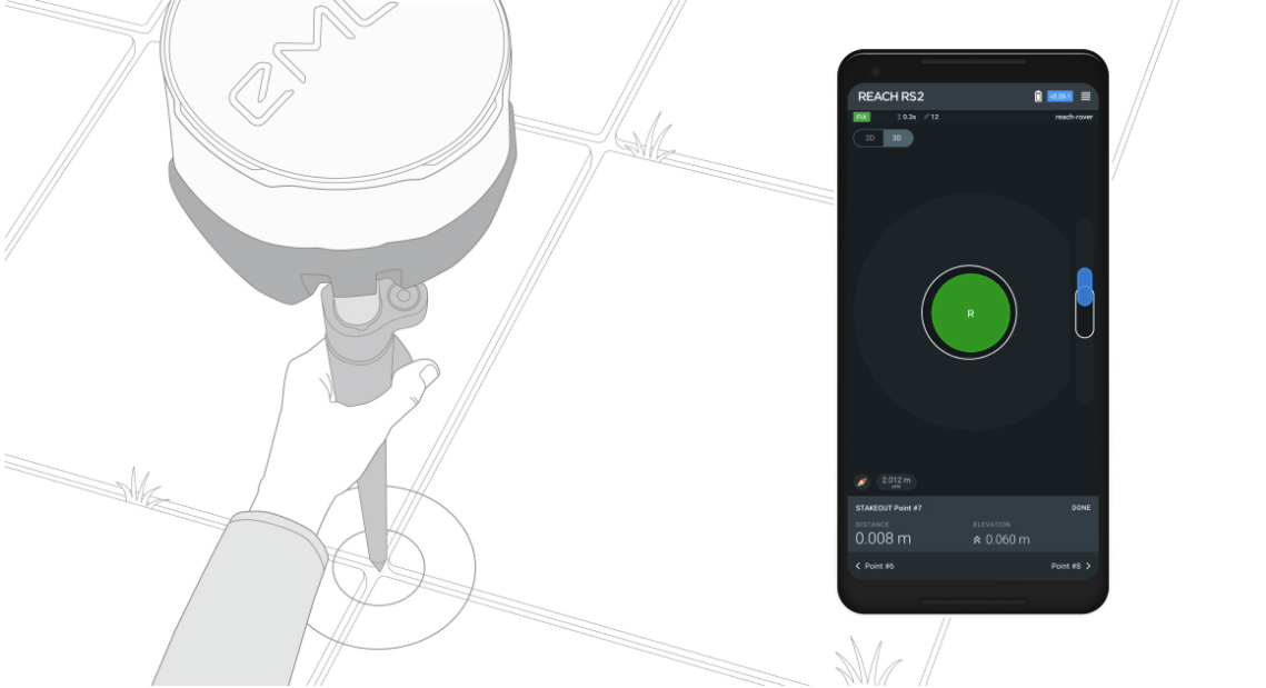
Stakeout is used to find exact physical locations of points. They can be collected in ReachView or imported from other CAD or GIS software.
Process of stakeout in ReachView has two steps: map view and bulls-eye. Map’s purpose is to help you navigate to points on long distances. When you get closer than 40 cm to the point, bulls-eye turns on to make it easier for you to visually match receiver and point.
- DXF
- CSV
- GeoJSON
Logging in RINEX: record raw data, position, and base correction logs
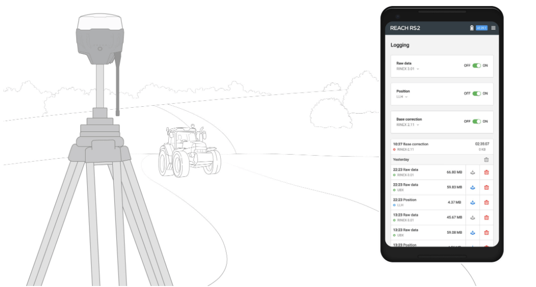
Record raw data, position and base correction logs. Point collection and recording of RAW data are independent processes and can be used simultaneously. ReachView has a simple and intuitive interface for logging configuration and control. We provide our version of RTKLib for PPK. It’s free and can be downloaded from our docs.
PPP for OPUS
RINEX raw data logs are compatible with PPP services so you can now get centimeter-precise results in any place on Earth. Process RINEX files in an online service and get position with absolute accuracy.


Reviews
There are no reviews yet.