Surveying Division
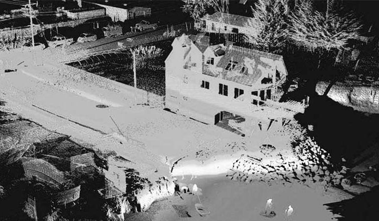
We are specialized and registered from Survey of Pakistan in conducting topographical, cadastral, engineering, and as-built surveys, the establishment of benchmarks, base stations with accurate and precise horizontal and vertical accuracy by using state of the art technology of DGPS, Total Station, and Drone services. The drones we used for conducting large-scale surveys are more accurate and reliable with rapid data acquisition and delivery and have the ability to fly in strong winds and cloud cover.
Triangulated Irregular Network (TIN), Digital Elevation Model (DEM), Digital Terrain Model (DTM), Digital Surface Model (DSM), Hillshade, Contours, Volumetric calculations, Slope Analysis, Viewshade Analysis, Catchment/Stream Delineation, Ground Water Analysis and various other performed by using our surveyed data depict the real ground picture, which provides engineers, architects, and planners a base to visualize and design as per ground realities from a building to large-scale housing project or an entire city.
Aside from topographical surveys MAPTech also provides its services for Land use Surveys, Road Inventories, Traffic Impact Assessment (TIS), and Socio-Economic Surveys and we never compromise on data quality.